
Originally we had planned a trip to the Sawtooths in Idaho some months ago. However, as has been the case with many trips this summer, wildfires have fucked everything up. As our trip date approached, the number of wildfires only increased and the air quality was shit everywhere. We searched for trips within reasonable driving distance including British Columbia, Washington, Idaho, Oregon, and Northern CA. The Olympic Peninsula was literally the only place we could backpack with decent air quality and no nearby fires. So at the last minute we called the trip in the Sawtooths and instead planned a similar trip in length in Olympic National Park.
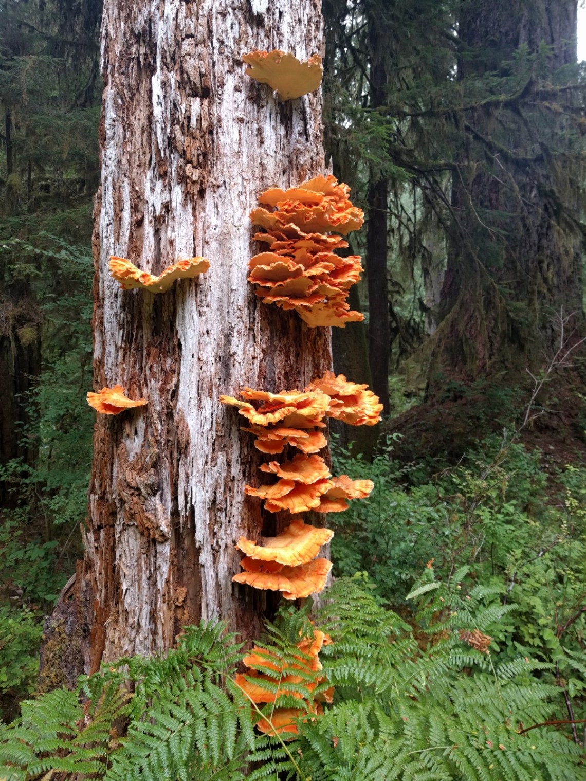
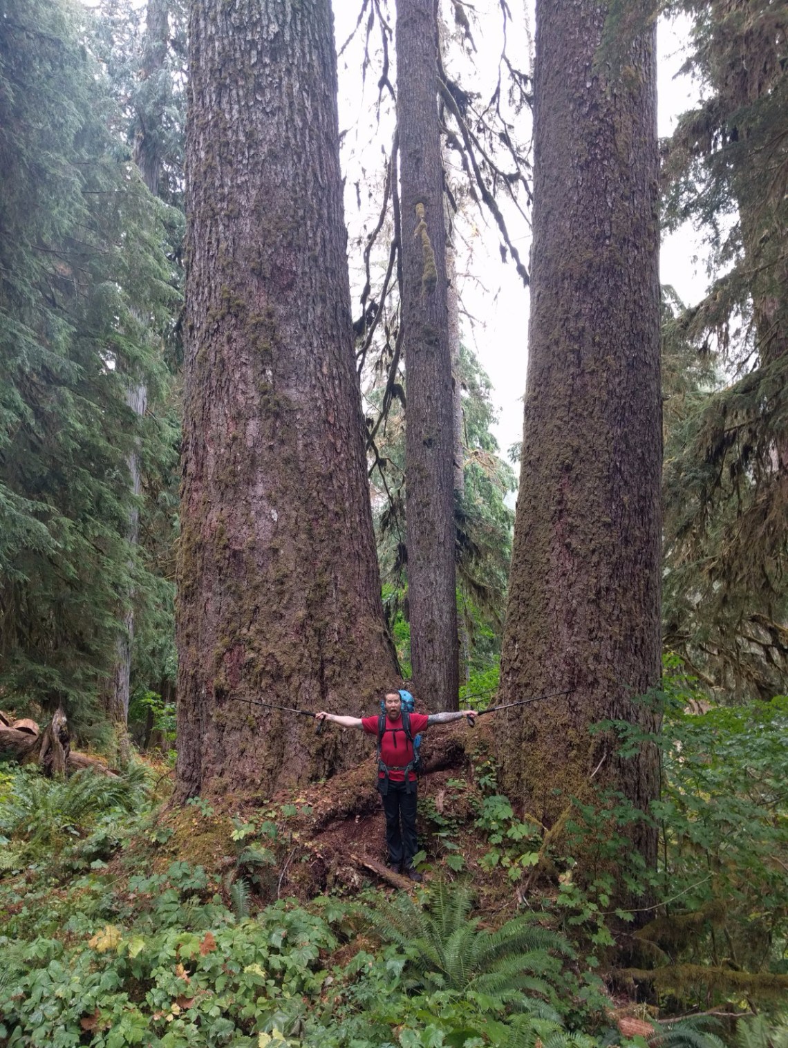
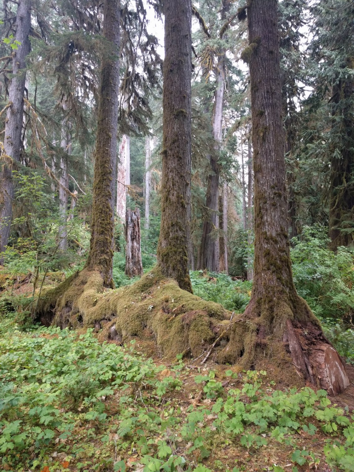
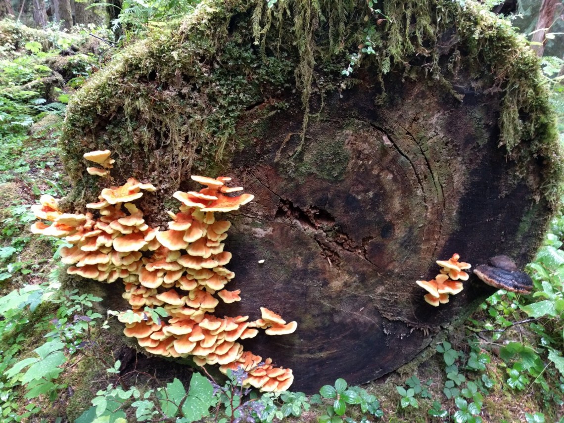
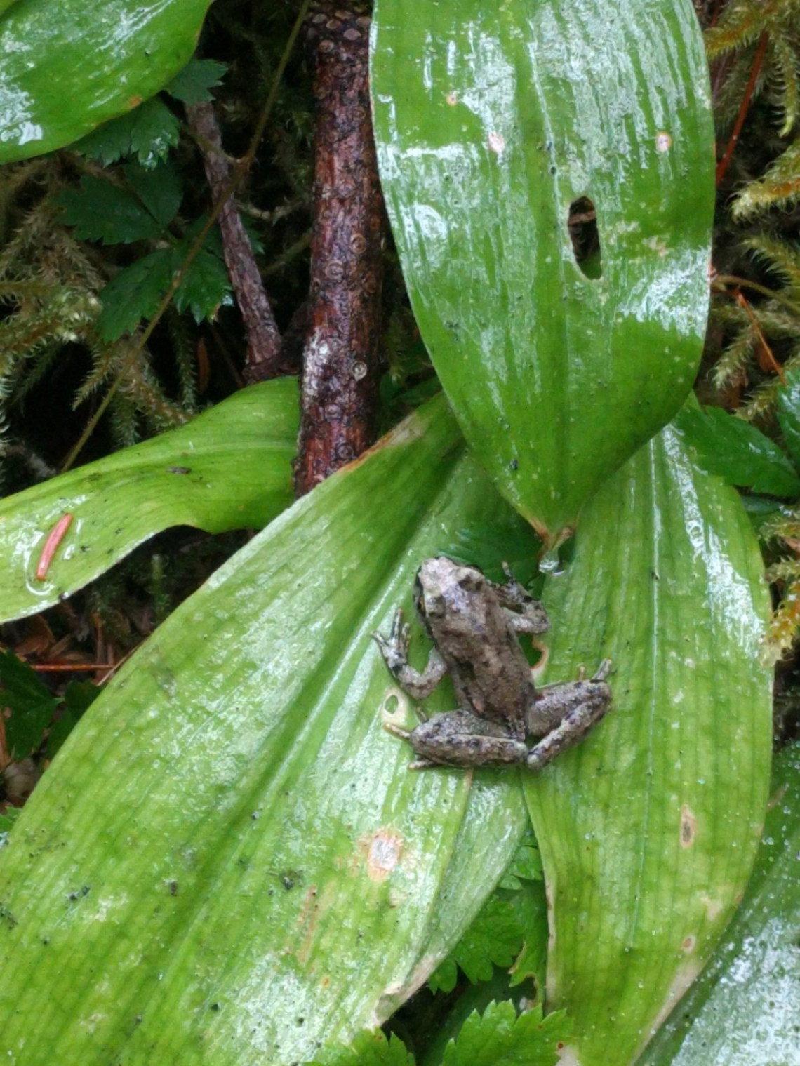
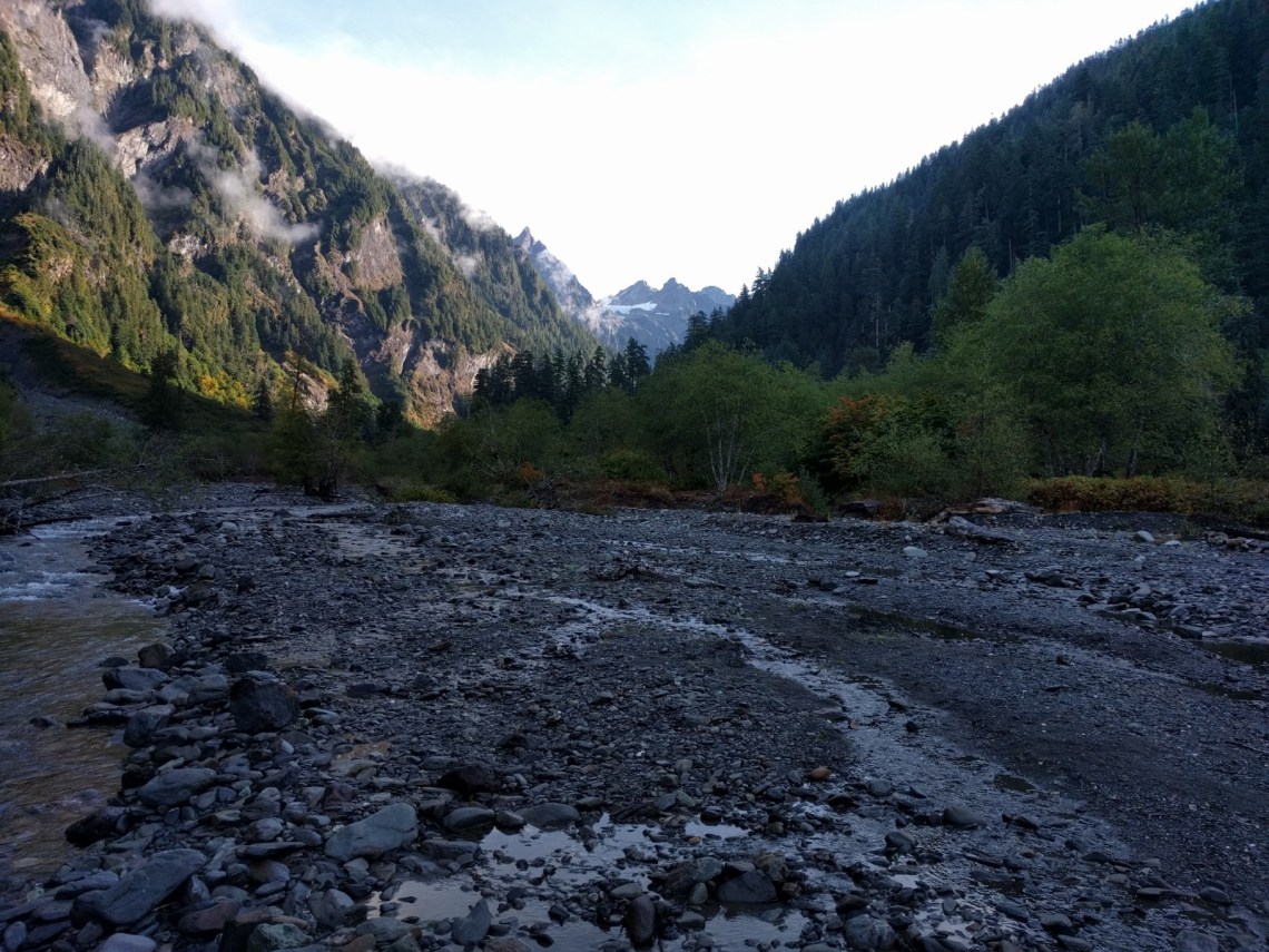
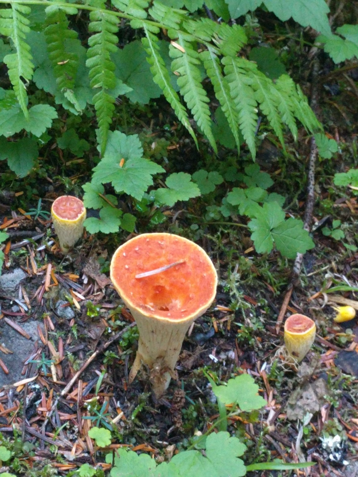
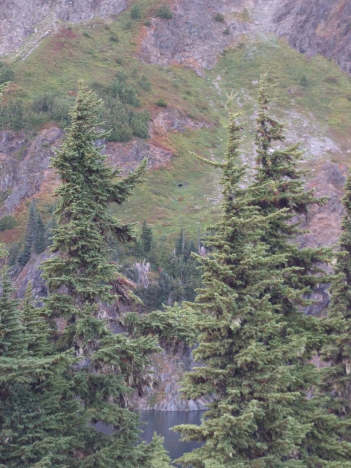
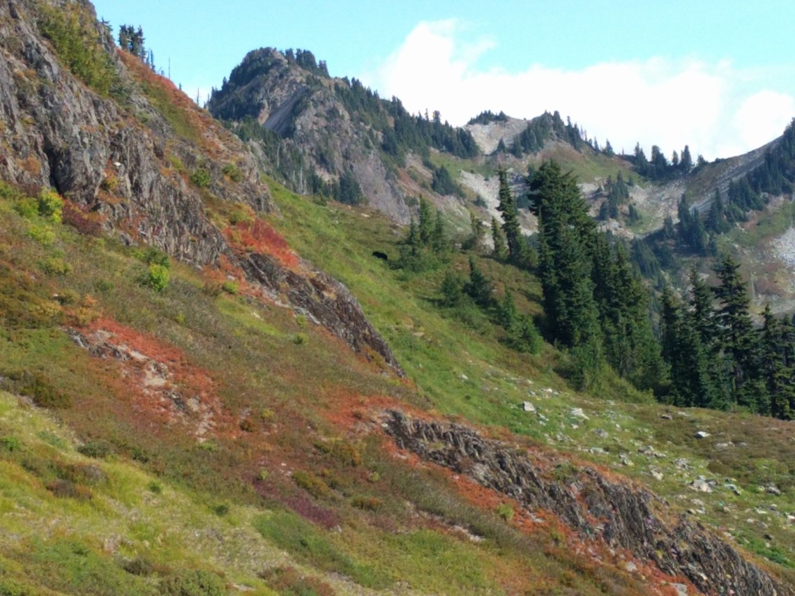
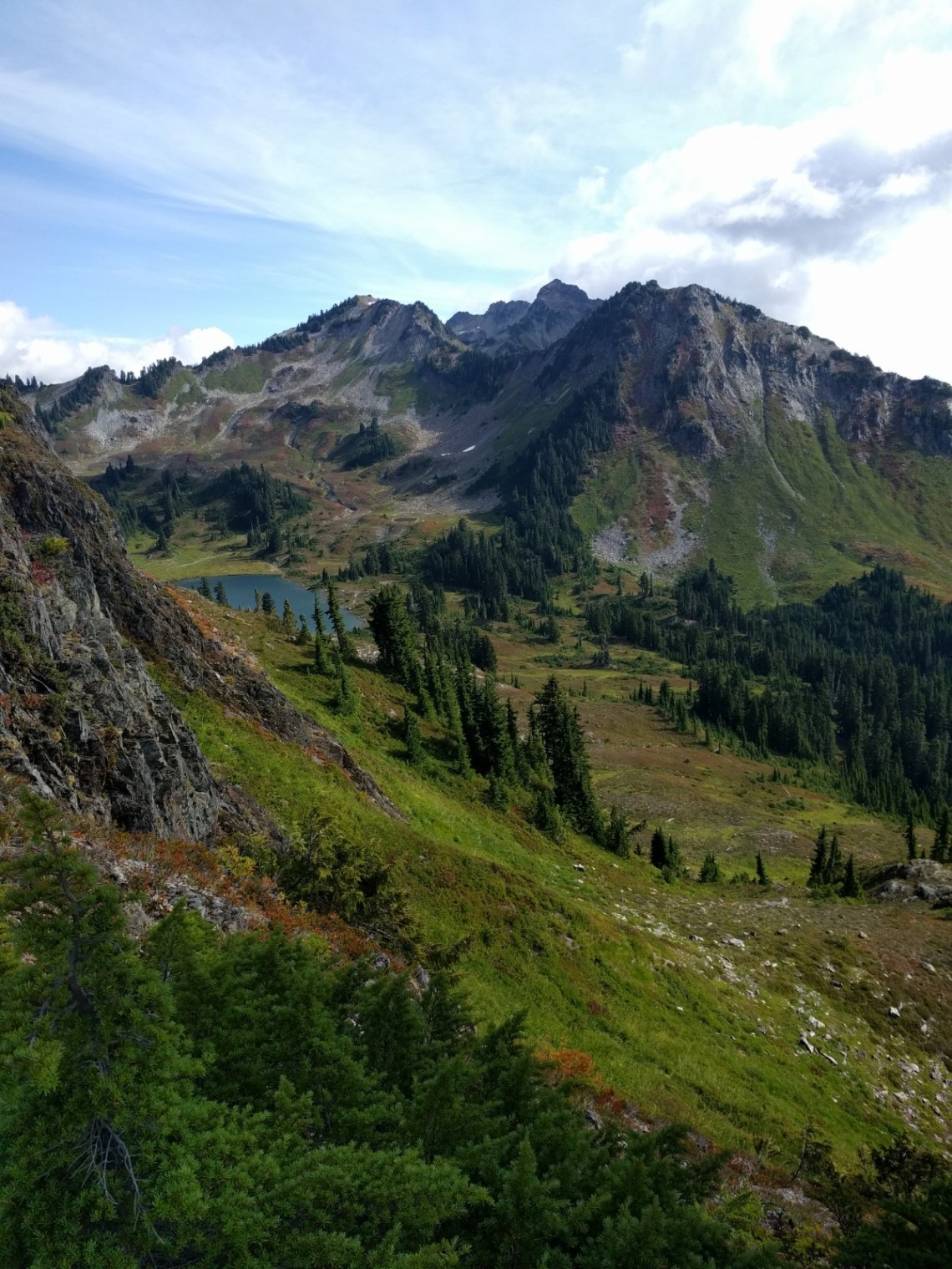
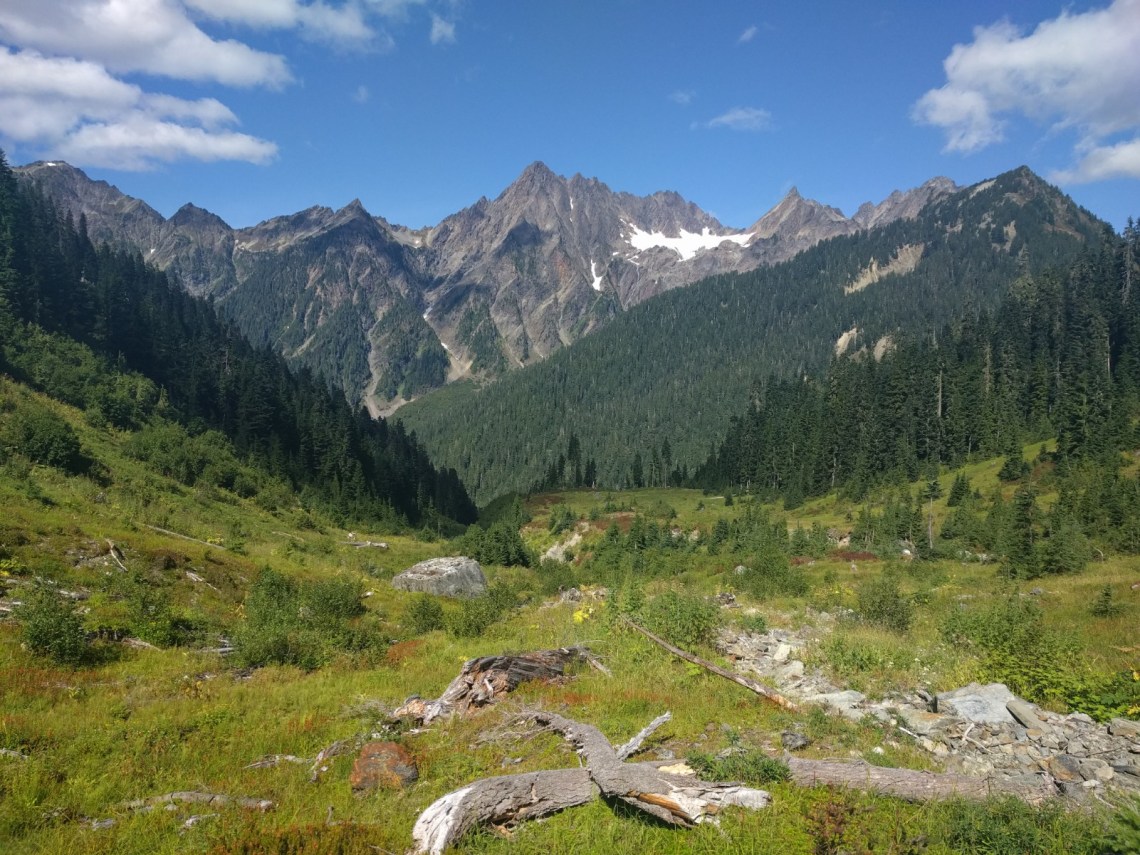
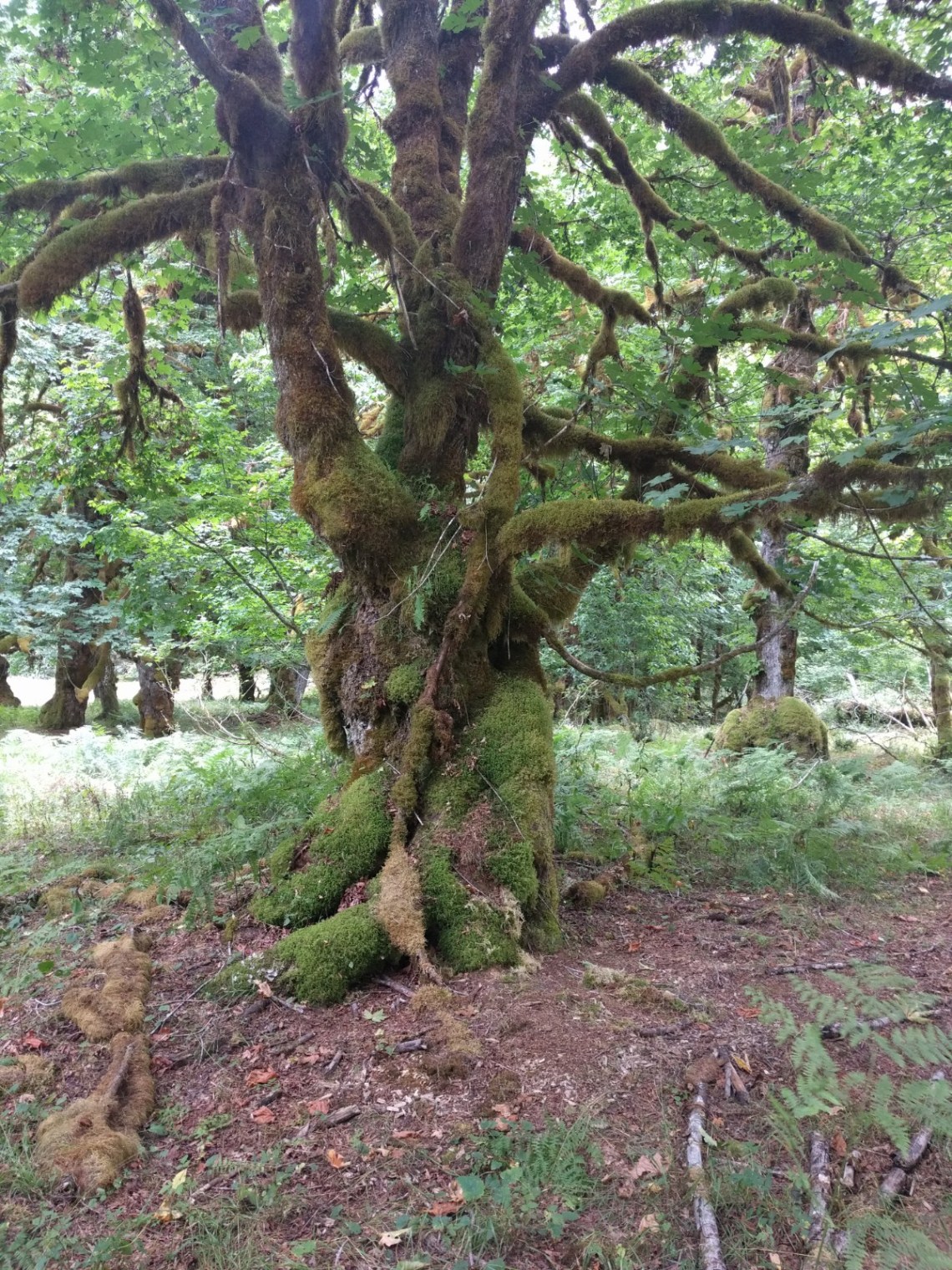
The scenery there is stunning, you’ll see many different types of environments ranging from temperate rainforest to high alpine environments. The views here are earned, requiring some significant elevation gains. Wildlife is abundant and most visible in the high alpine areas although other hikers saw tons of elk in the low Quinault Rain Forest. We were lucky enough to see three separate bears, but no elk unfortunately.
Once you’re up high, it doesn’t mean the trail stays high. At one point we dipped back down 3k feet only to reclaim all of that elevation the next day to get back into the alpine areas. There is nothing efficient about the trail network here. No ridge walks, you’re gonna work for it here, bitch.
Being inside the National Park, backpacking here is more regulated than I’m used to, requiring permits and bear canisters. Luckily the permits didn’t require reservations, but were pricey at $8 per person per night. Usually where I go it’s free.
We drove out immediately after work and stayed in Aberdeen, WA Friday night, getting up early and eating a big calorific breakfast before heading to the ranger station at Lake Quinault. Annoyingly, we had to acquire permits and dreaded bear canisters and drive another 45 min or so to the trailhead at Graves Creek, which was packed. We suspected a lot of other people changed their backpacking plans as well (they had).
I used Caltopo and the book Backpacking Washington by Douglas Lorraine as a resource in planning. I used Strava for daily tracking to nerd out to elevation gain, pace, distance, etc.
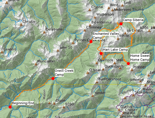
Here is the route we took (thank you Caltopo), a “lollipop” loop, beginning and ending with a long walk through the Quinault Rain Forest along the East Fork of the Quinault River:
I’ll give an overview of each day in this post, relying on the photos to tell the story.
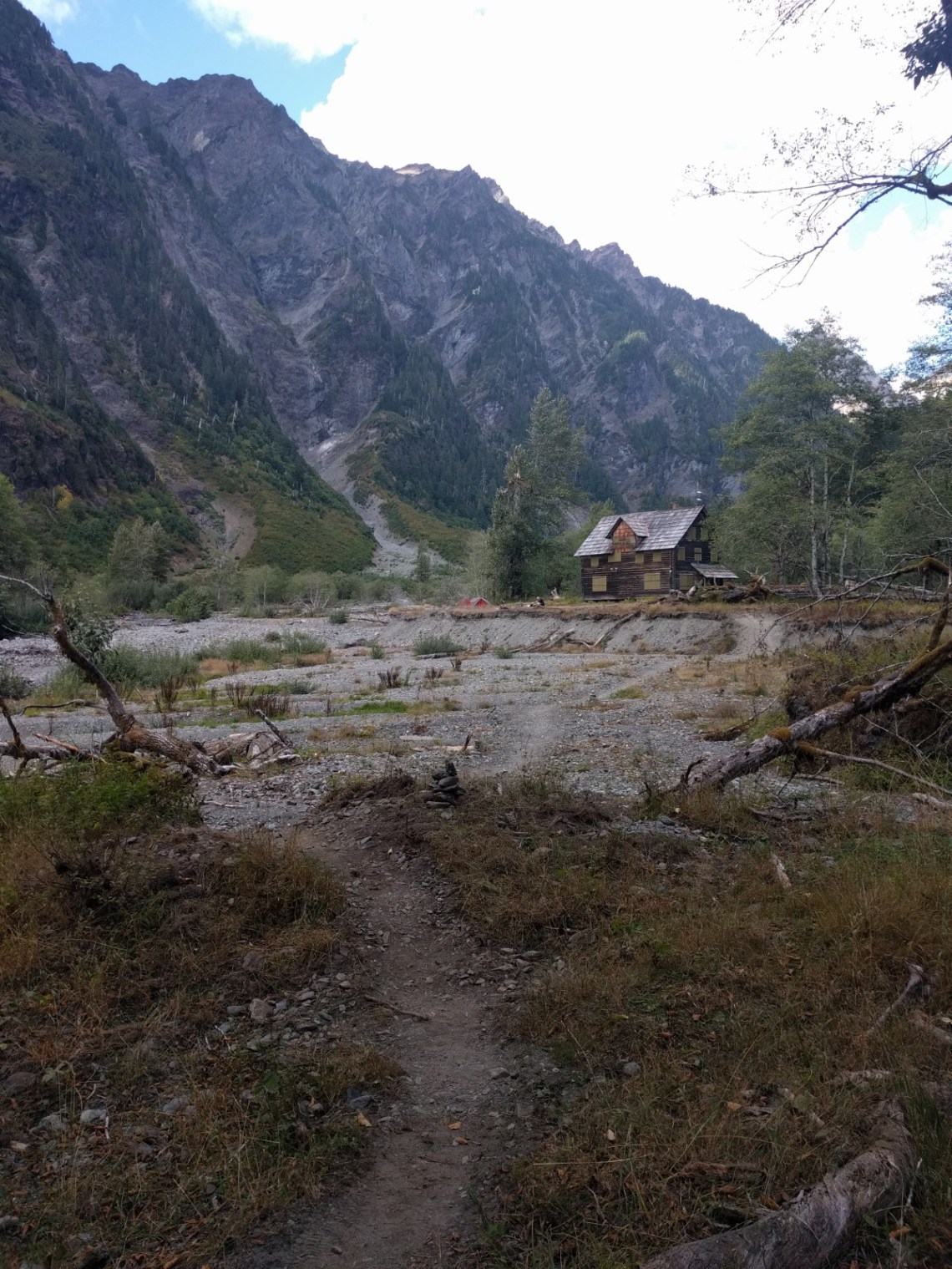
Day 1: Graves Creek Trailhead to Enchanted Valley Camp
13.9 miles, 2944′ elevation gain, average pace of 20:47 per mile
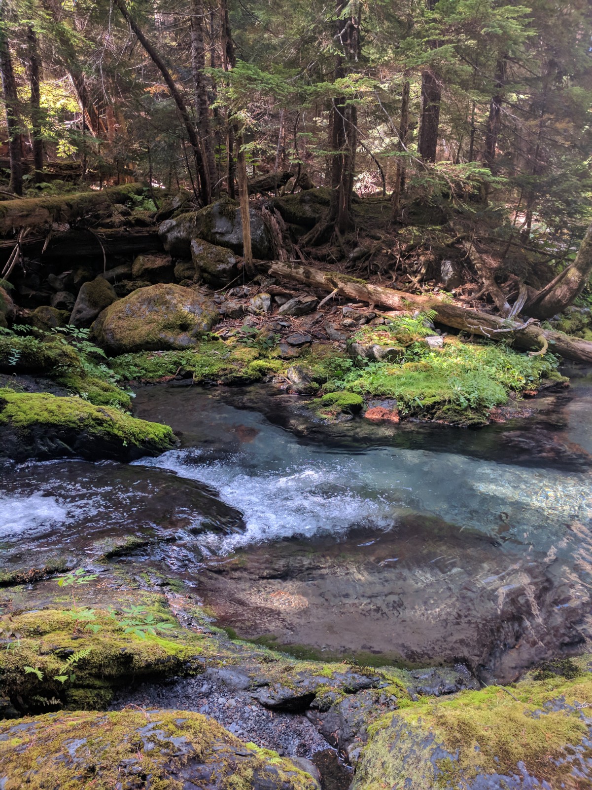
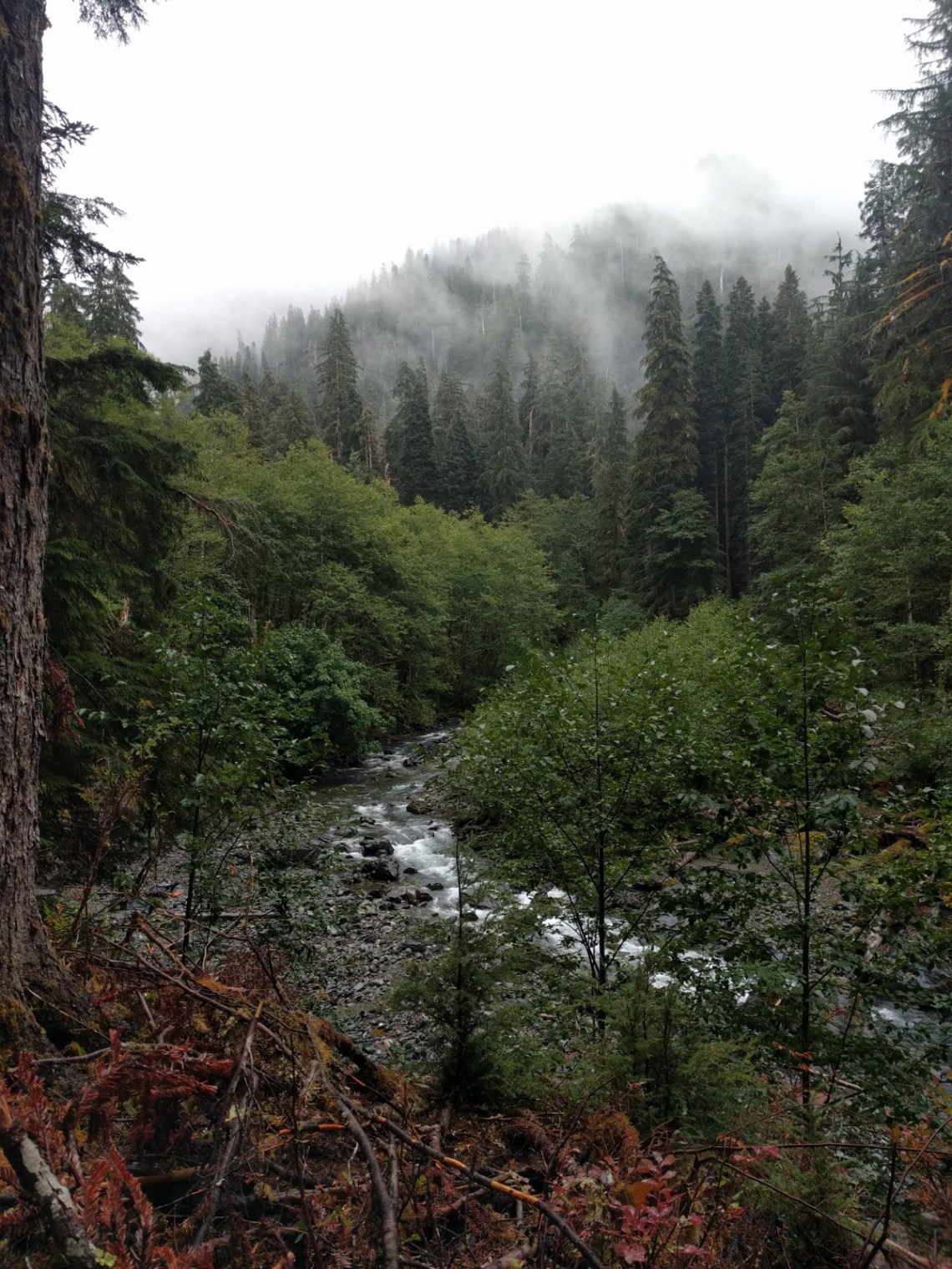
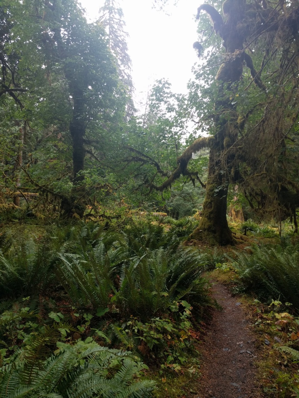
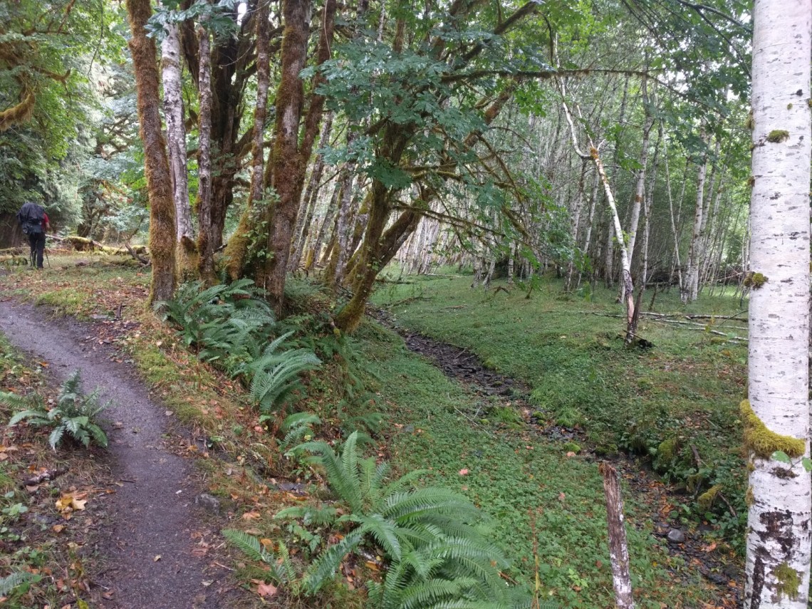
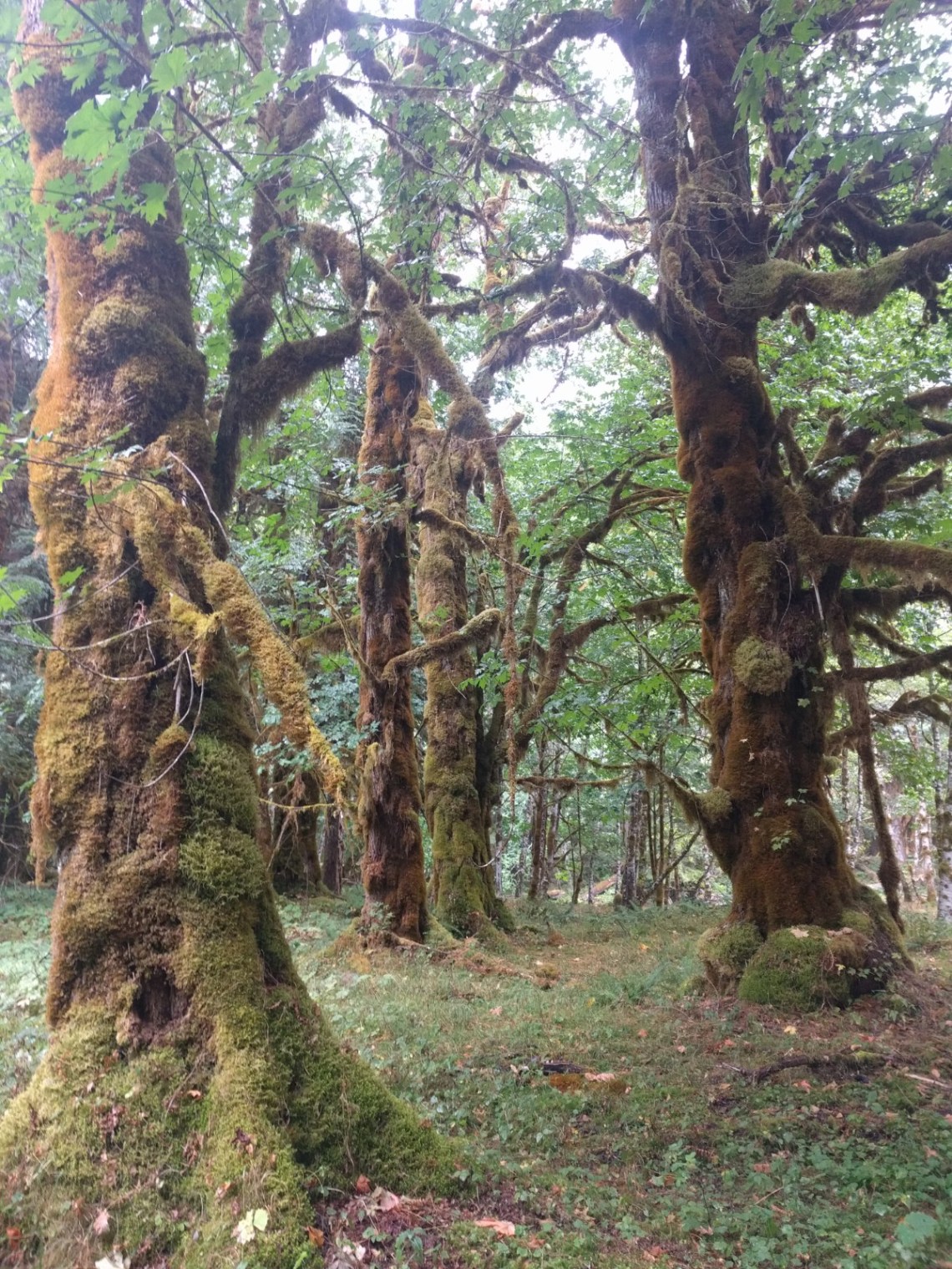
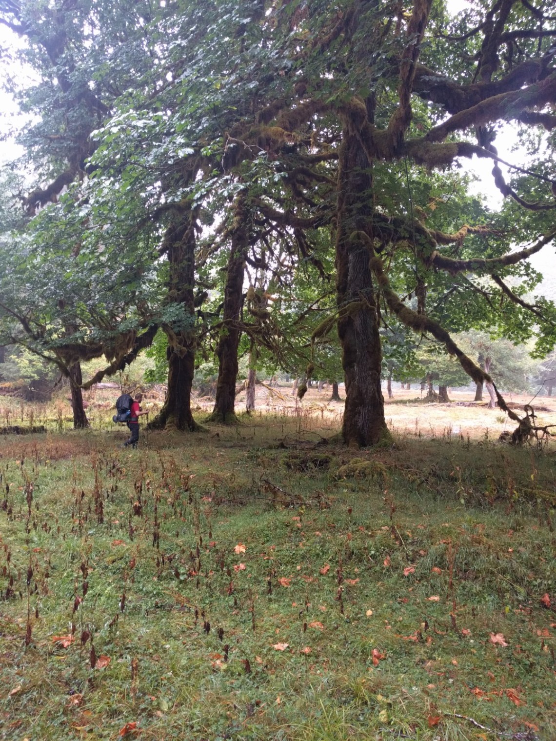
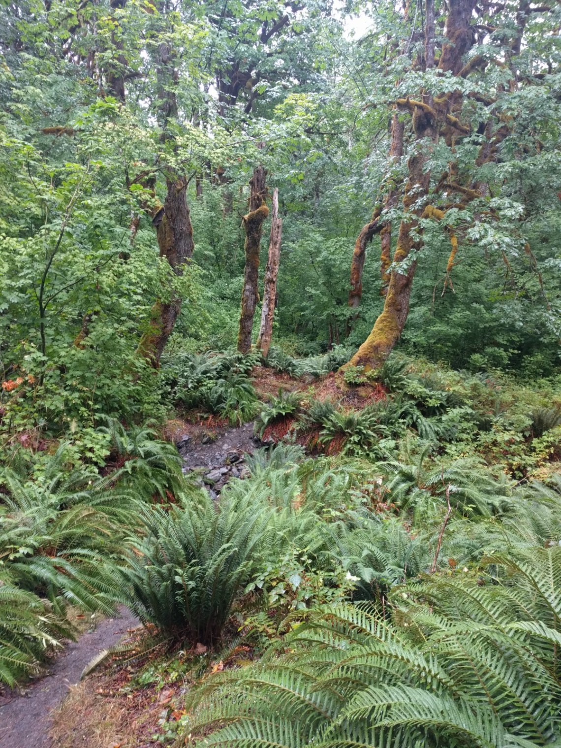
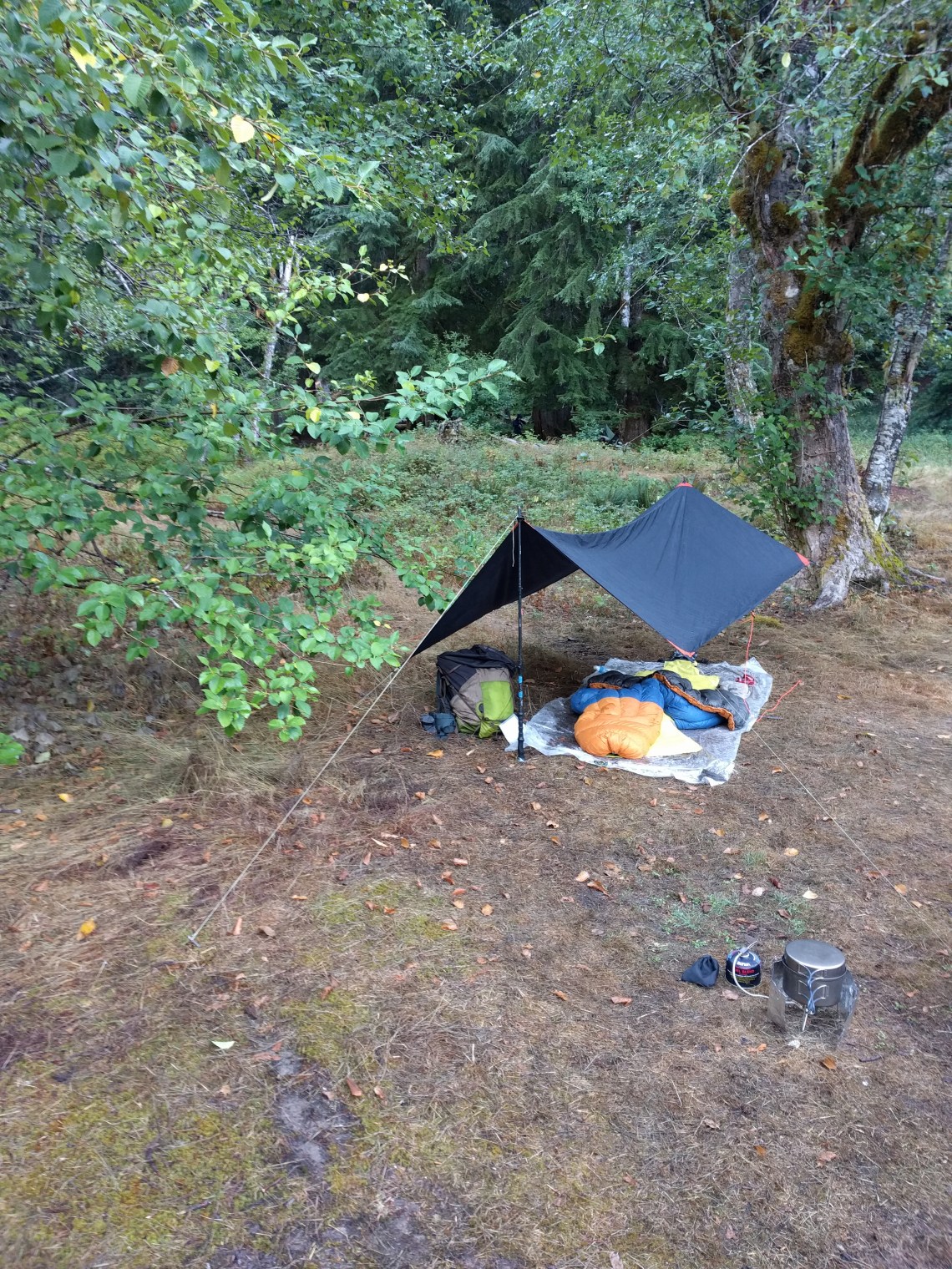
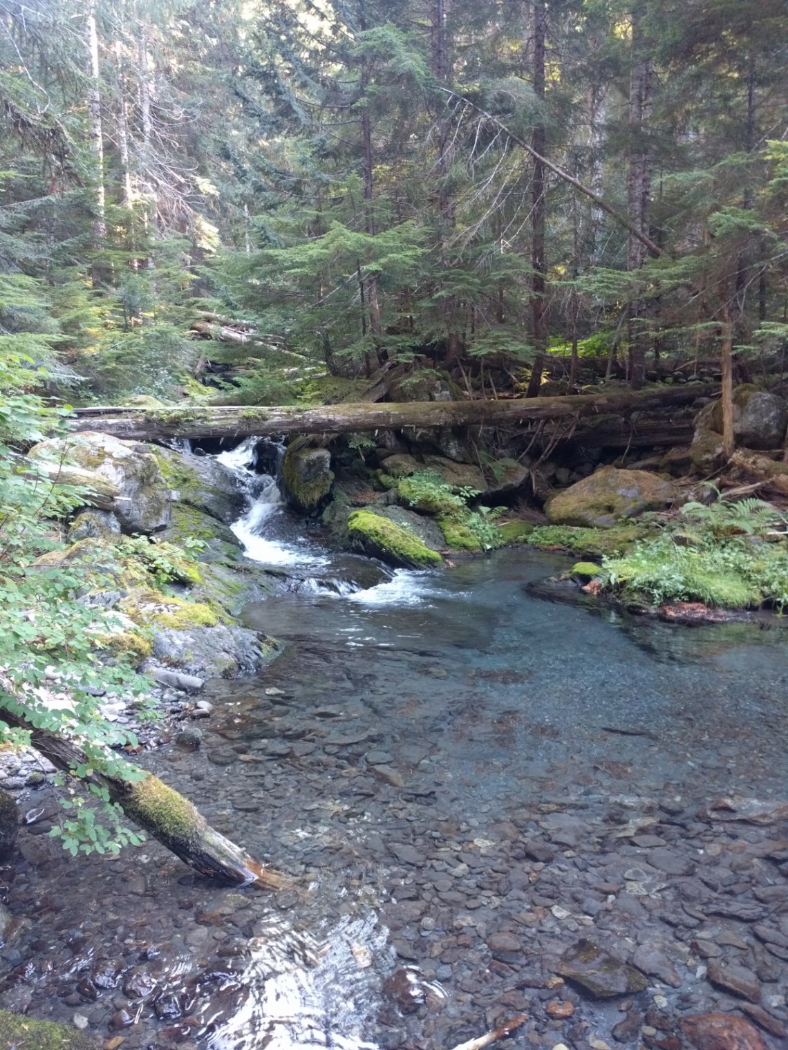
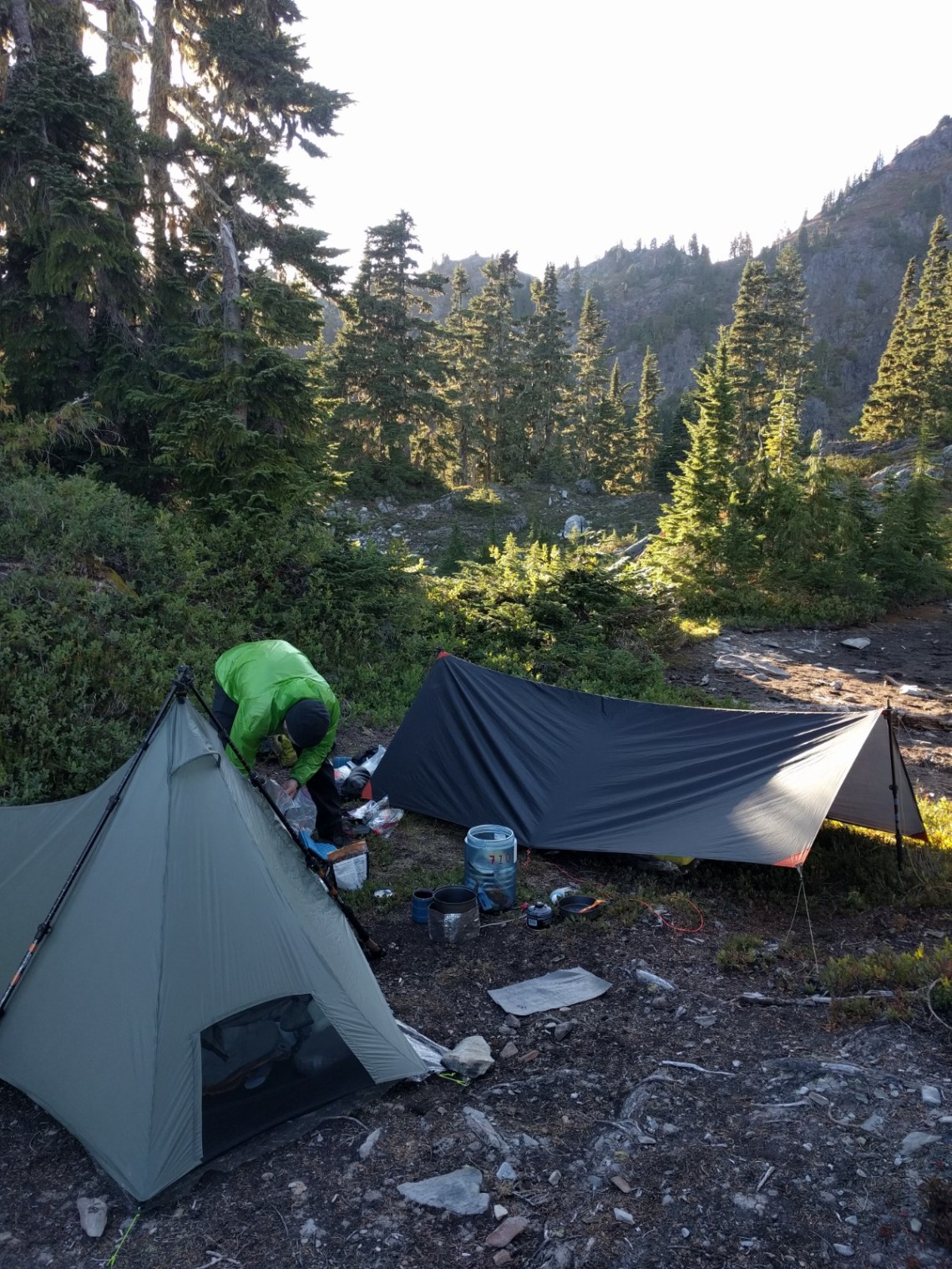
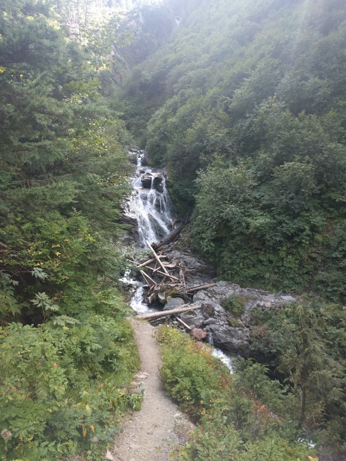
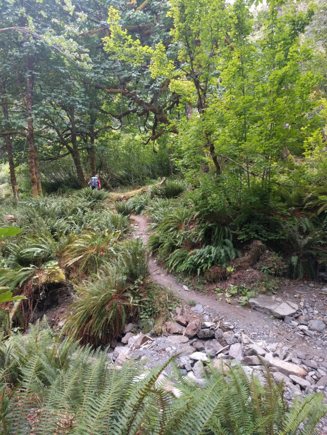
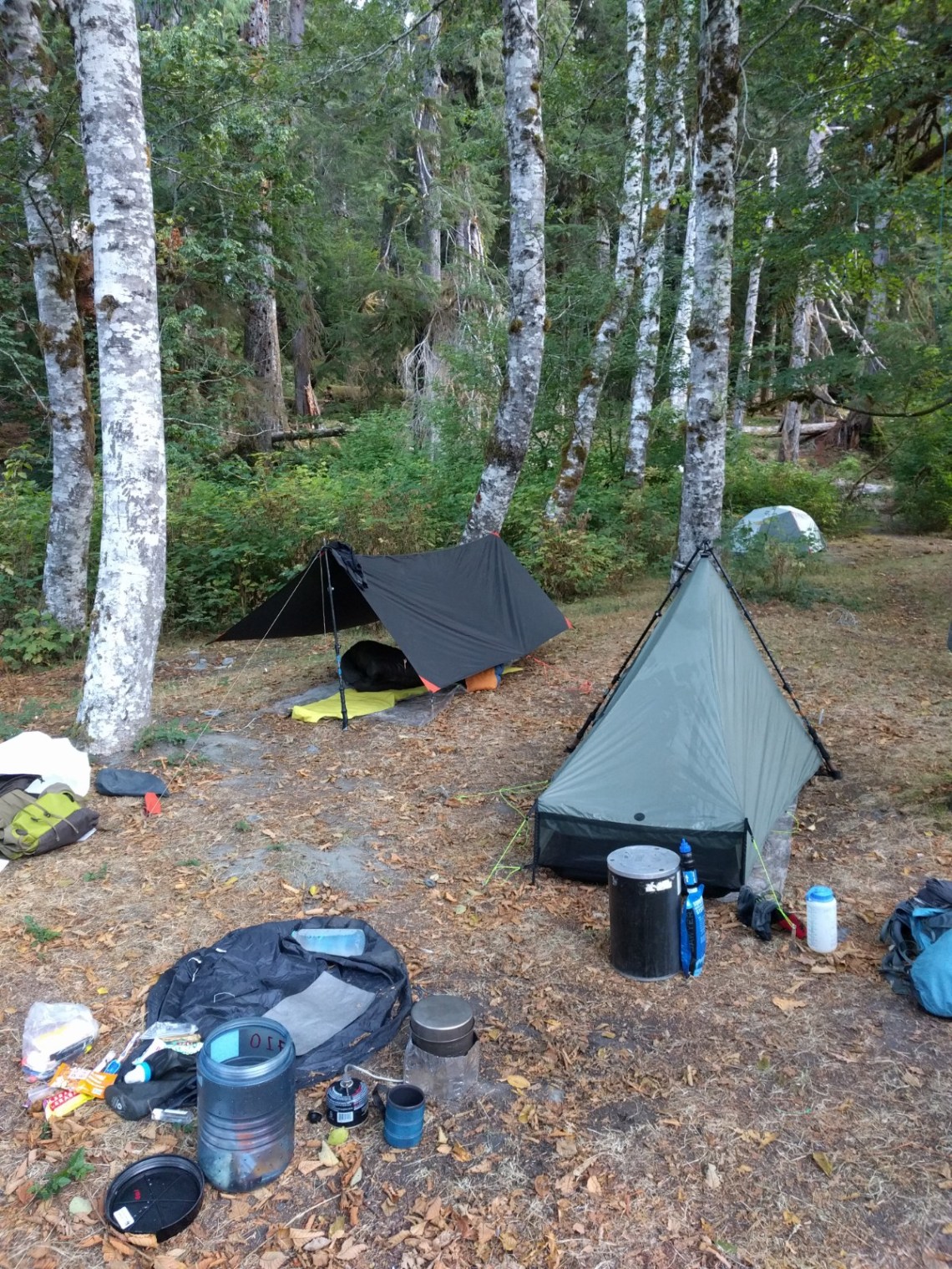
This part of the hike was a long slow incline up the East Fork Quinault River Valley in the rain forest. It was beautiful as the landscape changed from deciduous meadows to fern covered forest and back again. The day ended with me having an uncomfortable psychedelic experience that evening thanks to a bad reaction to what I thought would be a pleasant edible. I spent a good portion of the early night shaking uncontrollably and convinced I’d ruined my whole trip. It was like a few months of therapy all rolled into one night as I lay shaking, wrapped up in my quilt under a homemade tarp with all my clothes on. A bad experience on edibles is like any other negative experience in life, eventually it’ll pass. You’ve just gotta let go and ride that shit out. Needless to say I’m done with edibles, they’re too inconsistent and unpredictable for me.
The next morning all of our gear was soaked with heavy morning dew and we packed up wet the next morning. I had slept past 9. I felt like shit.

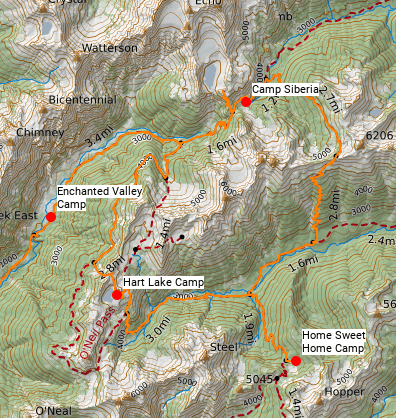
Day 2: Enchanted Valley to Anderson Pass/Anderson Glacier to Camp Siberia
7.4 miles, 3415′ elevation gain, average pace of 26:57 per mile
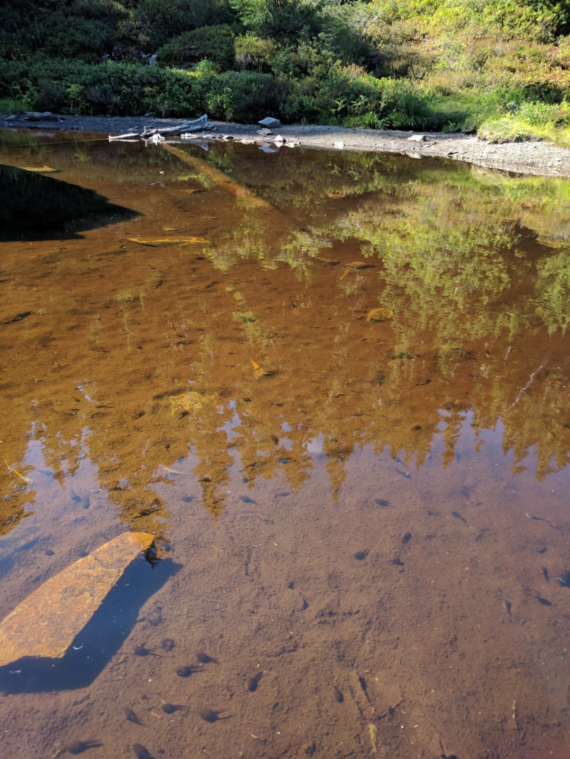
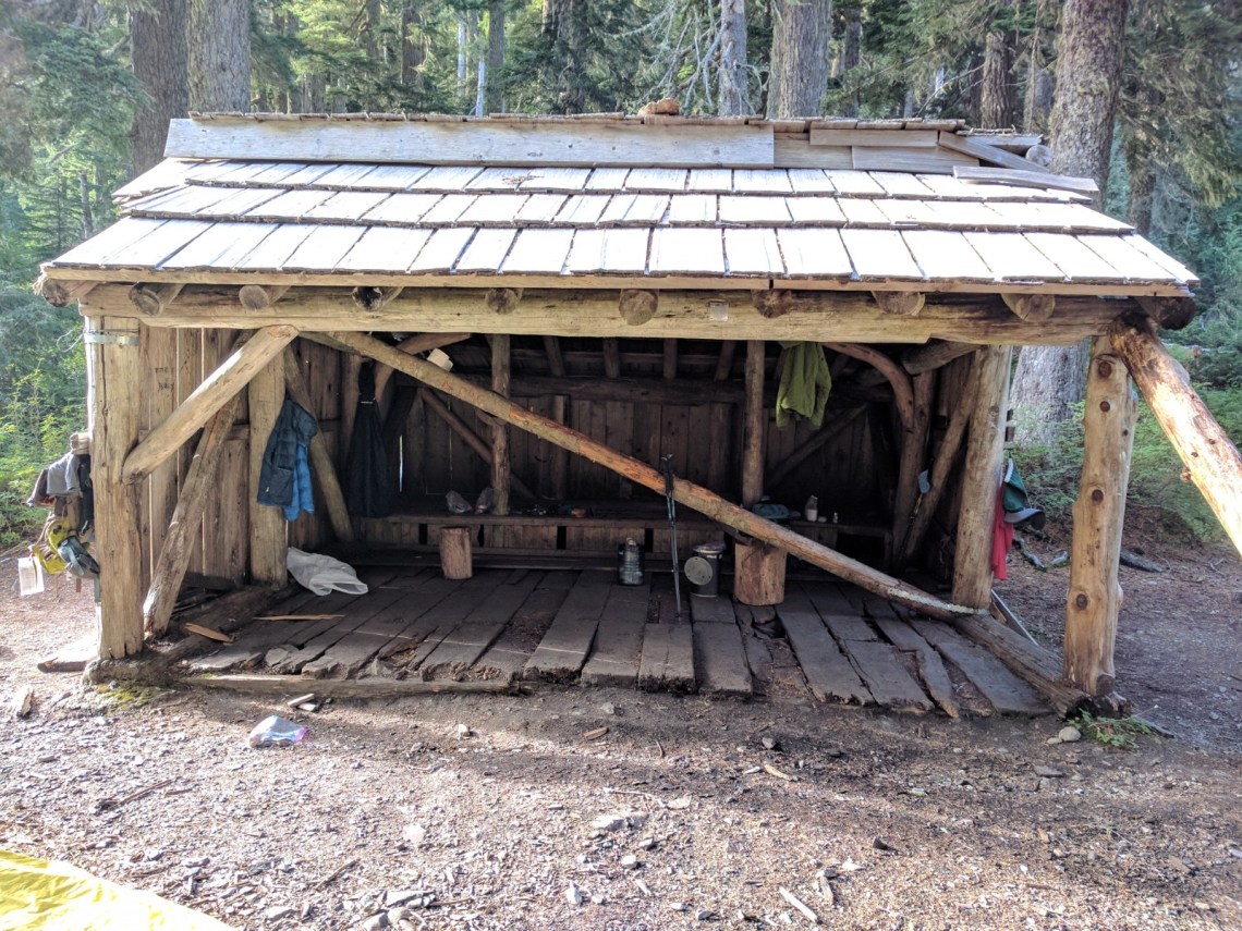
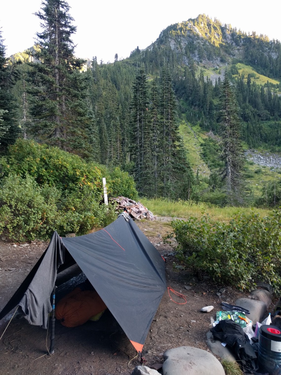
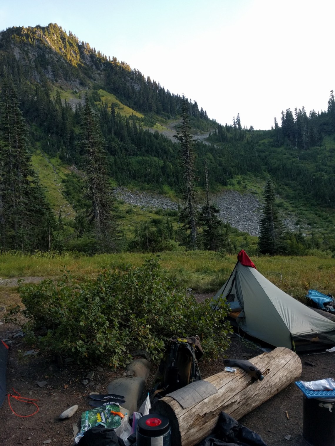
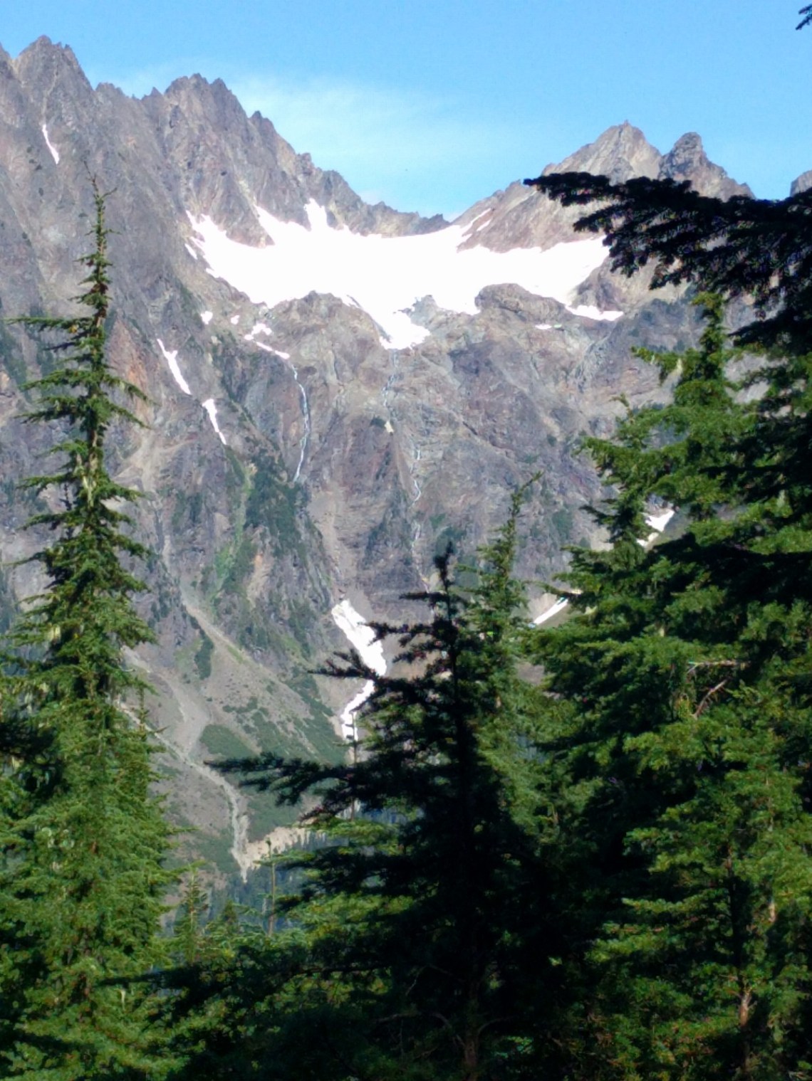
This day took us more steeply up to Anderson Pass and higher still to Anderson Glacier Viewpoint (it has retreated to the point of not being visible). After this we headed down in elevation and camped in the Camp Siberia adirondack shelter. We were able to hang all our gear out to dry from the previous nights soaking dew. My brain was also able to dry out.
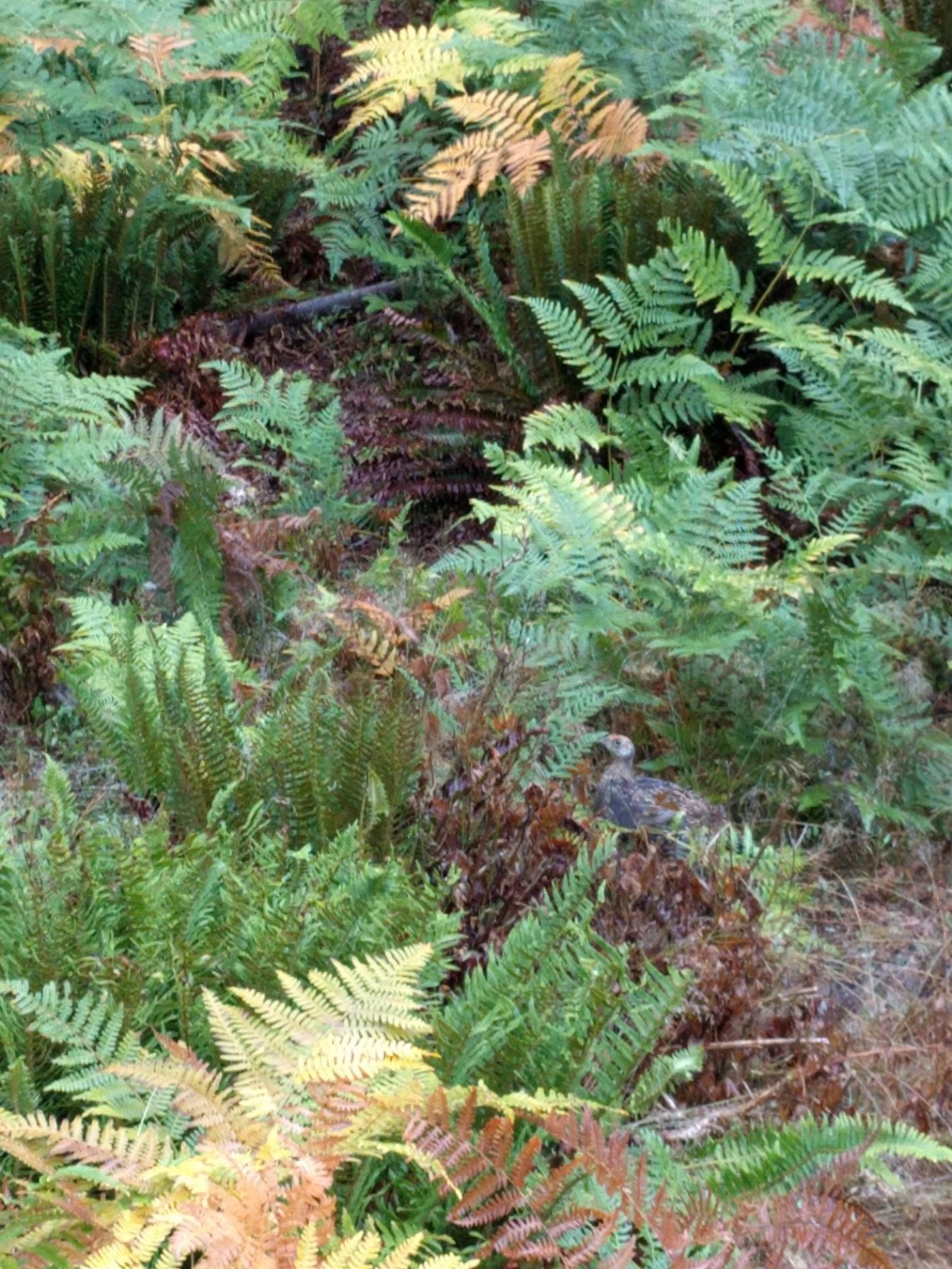
Keep an eye out for the grouse in the photos:
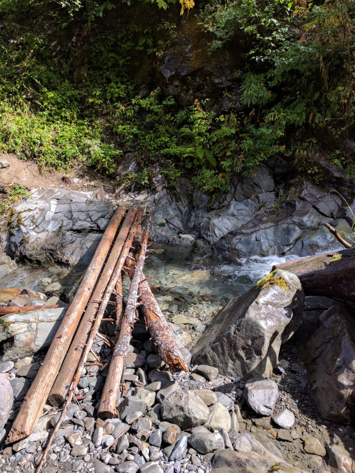
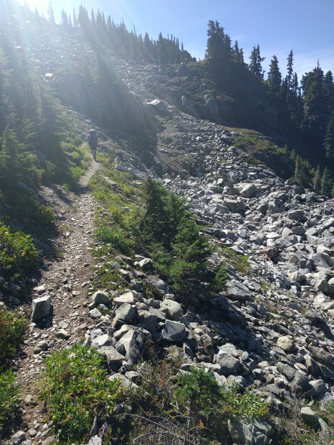
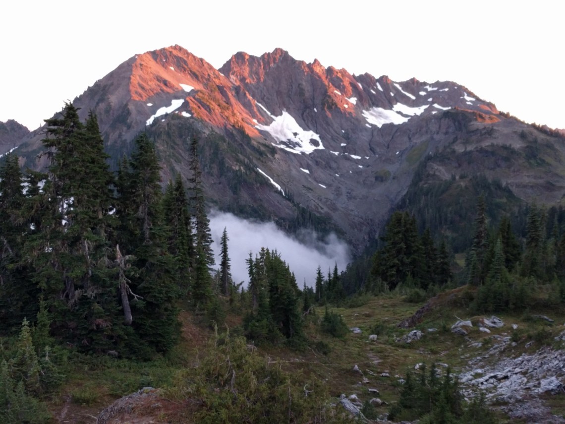
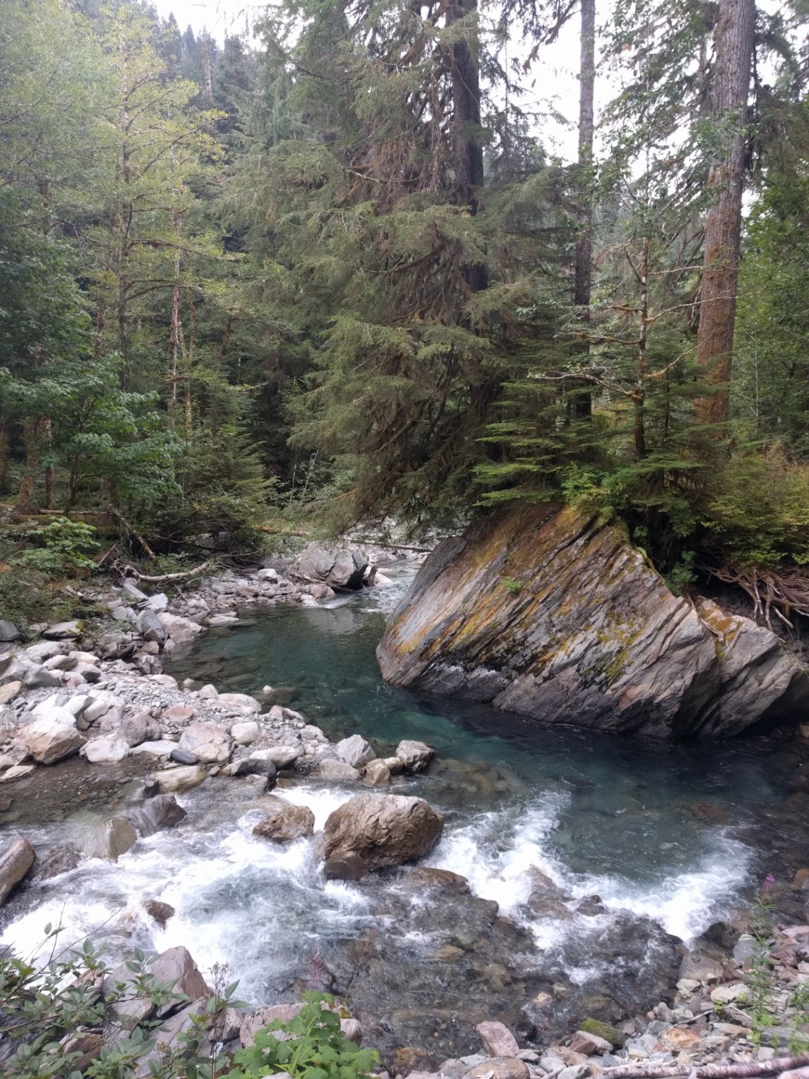
Day 3: Camp Siberia to LaCrosse Pass to Duckabush River to Home Sweet Home Camp
10.9 miles, 3852′ elevation gain, average pace of 26:07 per mile
While my night at Enchanted Valley felt like the longest night of the trip, Day 3 was felt like the longest day. We made good time to LaCrosse Pass, and descended 3k feet back down to the Duckabush River. At 4pm, we reached Upper Duckabush camp, but decided to make our day harder by climbing up another 1.5k feet or so up to Home Sweet Home Camp. It’s a beautiful spot, but shitty for camping especially since one prick took up two spots.

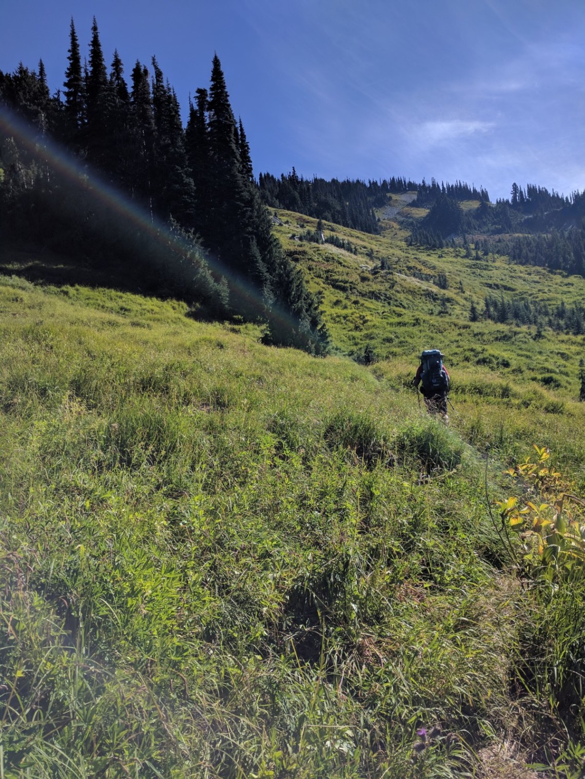
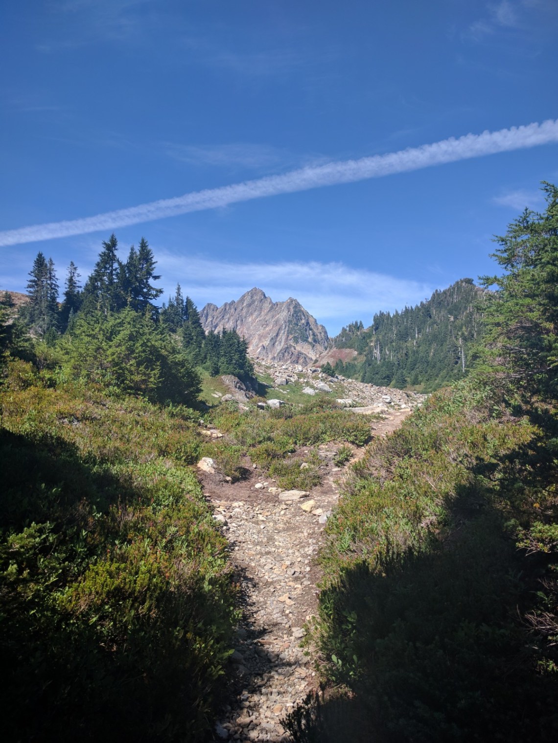
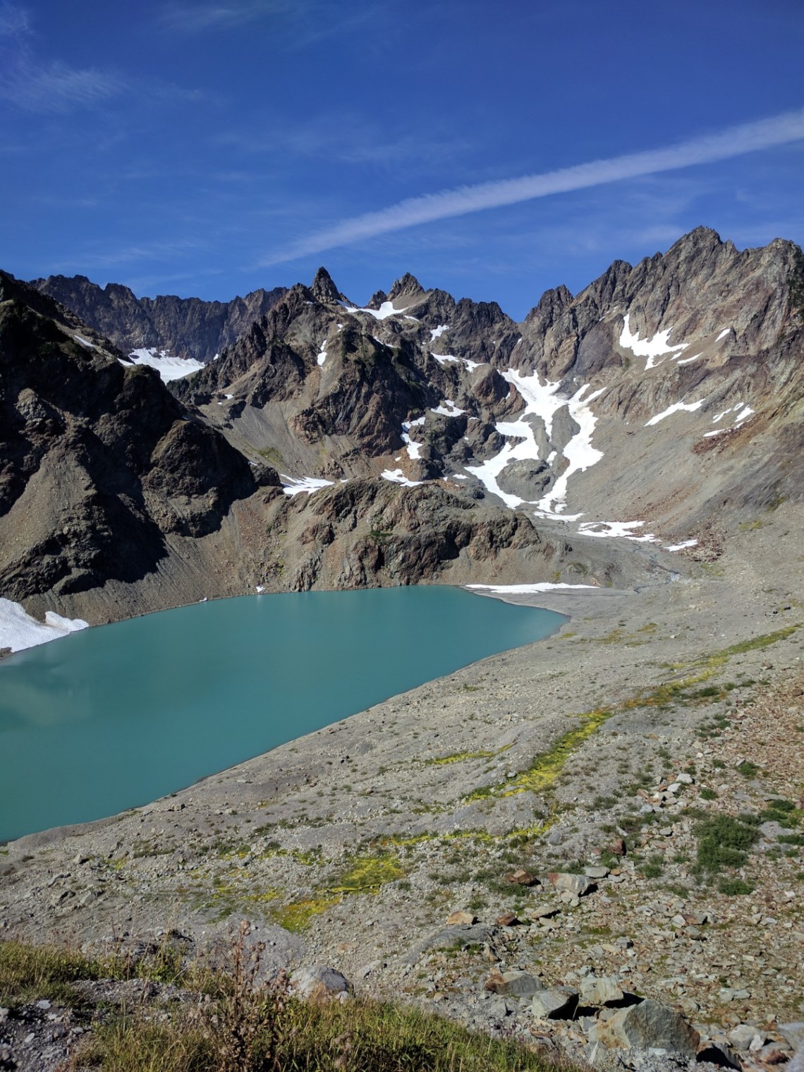
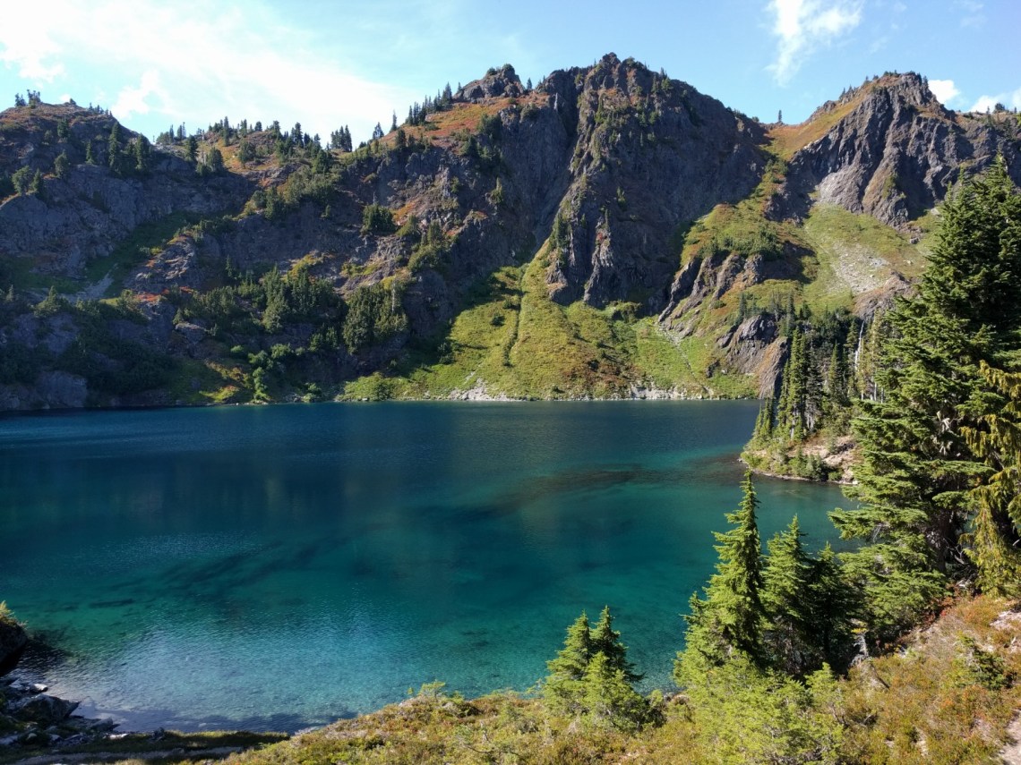
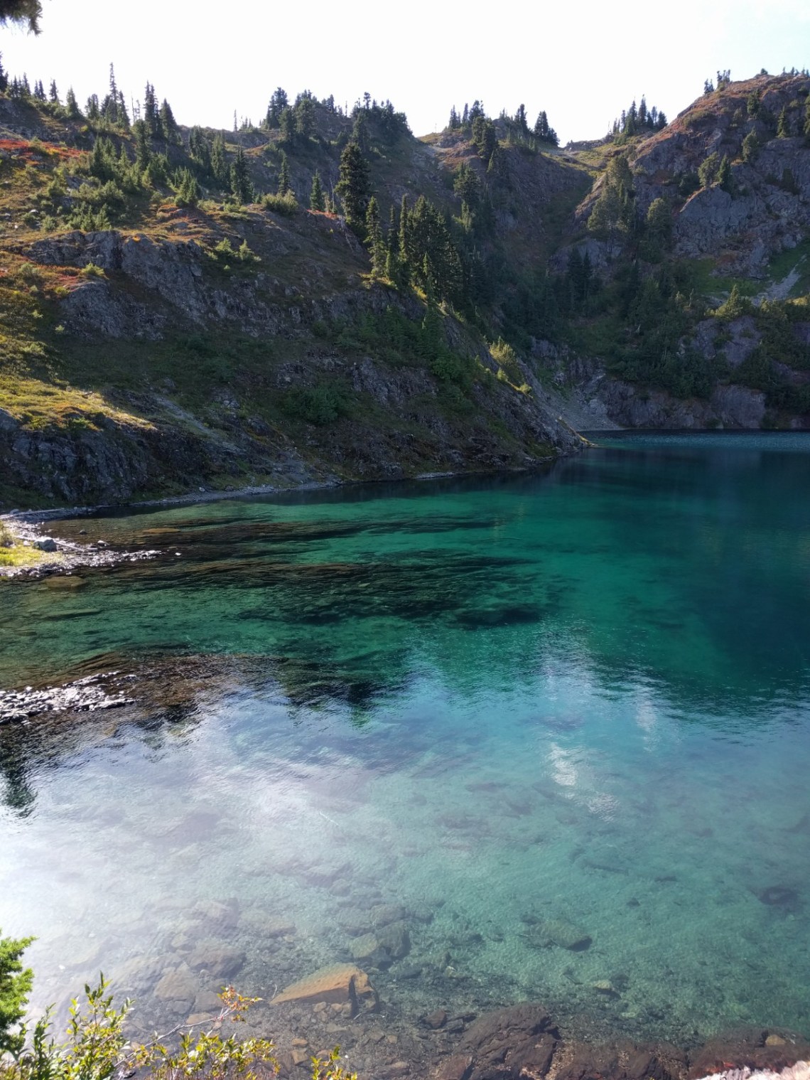
Day 4: Home Sweet Home Camp to Hart Lake
6.9 miles (nice), 2596′ elevation gain, average pace of 27:36 per mile
Best scenery day by far! Hart Lake and nearby Marmot Lake are excellent places to be. Marmot Lake is far more crowded. Next time we’ll be doing LaCrosse Lake further up in the basin.


Day 5: Hart Lake to Hart Pass to O’neill Creek Camp
15.7 miles, 1476′ elevation gain, average pace 23:09 per mile
Instead of taking the long way around to Oneill Pass, we chose a faint route on the map across Hart Pass. It is not on most maps however. On the way up to the pass the trail was well visible and pretty straightforward. On the way down from the pass was the steepest trail I ‘ve ever backpacked on, requiring us to use vegetation to lower ourselves down the route. The final bit is along a wash/avalanche chute back down to the long trail. We cut off around 3 miles and had a great experience going over this pass.
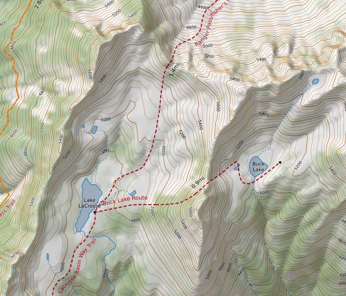
An additional option to exit this area is to go to LaCrosse Lake and take another pass up and over using Fisher’s Notch. We couldn’t see this trail from either side, only attempt this if you know what you’re doing and have time to kill. It looked incredibly sketchy. I did find one report of it being done here. The route on the map below that looked very dicey in real life is labeled as Ranger Pass/Fisher’s Pass. Buck Lake in person looked like a batshit insane hike, I can’t even believe there is a trail there. Next time this is the area I’ll be going back to:
After going over the pass, we cranked out as many miles as possible to make the next day’s hike a bit easier. We went past Enchanted Valley Camp all the way to Oneill Creek camp, which was unexpectedly packed. Now for the photos:


Day 6: O’neill Creek Camp to Grave Creek Trailhead
6.6 miles, other info unknown because Strava lost GPS connection
Nothing really notable about our final day. We were just in pain, trying to high tail it out. I’m always bummed to be leaving the wilderness, but happy to know I’ll be cleaning up and getting a beer and a meal soon.
Feel free to comment if you have any questions!

I know I’m late to the game, but I love reading trip reports and loved yours and the photos. Me and a buddy did a very similar route about a year after you and we took the Fischer’s Route option. It’s as dicey as it looks, though sounds about the same as the shortcut you took (which we also considered). If you ever are back in the area, I’d highly recommend it because it leads into a beautiful, and likely seldom seen, area. Here’s my trip report if you’re interested: https://imgur.com/gallery/VfFzn3j
LikeLike
Hey thanks Nate! I will definitely do Fishers Notch next time, and your description and photos of it are awesome. Have a great summer
LikeLike